CNN
—
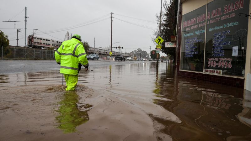
US Highway 101, one of California’s most famous routes, closed in both directions in south San Francisco Saturday as heavy precipitation and snow melt are flooding roads, especially in the northern half of the state.
The California Department of Transportation also advised of a partial closure of Interstate 80 near the Nevada line midday Saturday “due to multiple spinouts over Donner Summit.” Driving through the mountain pass in the Sierra Nevada range has required tire chains for much of this month due to heavy snowfall.
A strong storm began to bring widespread heavy rain Friday through Saturday, creating a flood threat for much of Northern and Central California. An active jet stream pattern also continued to bring a parade of storms fueled by an atmospheric river of Pacific moisture.
An atmospheric river is a long, narrow region in the atmosphere which can transport moisture thousands of miles, like a fire hose in the sky. This heavy rainfall will slide southward to Southern California on Saturday and Sunday, accompanied by gusty winds of 30 to 50 mph.
Several small communities in northern California were put under evacuation orders and warnings Saturday due to flooding. Three communities near the city of Watsonville were told to evacuate by the Santa Cruz County Sheriff’s Office due to creek flooding, while officials ordered the communities of Paradise Park and Felton to evacuate due to rising levels of the San Lorenzo River.
Neighborhoods near the Santa Rita Creek in Monterey County were put under a warning Saturday afternoon because of concerns the creek “will spill over its banks,” according to the sheriff’s office.
A flood watch for more than 16 million is in effect including the entire Bay Area and Central Valley though Saturday night. Rain could ease Saturday evening before the calendar turns to 2023.
Earlier weather predictions said widespread rainfall accumulations of 2 to 4 inches are expected in northern and central California, but locally higher amounts of 5 to 7 inches are also possible for the foothills.
Northern California and the central California coast have already received 2 to 4 inches of rain in the last week. The cumulative effect of multiple Pacific storm systems laden with moisture from a potent atmospheric river will make impacts such as flash floods and landslides more likely.
Videos and photos shared by the National Weather Service in San Francisco show fallen trees blocking roadways, and multiple landslides.
“Downtown SF rain gauge now reporting 5.33 inches for today,” the National Weather Service office in San Francisco said. “Making a run for wettest calendar day ever… (records go back to 1849).”